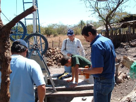
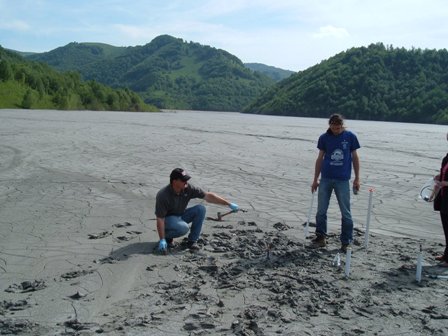
An unsaturated zone transport project in Santa Rosa area of El Salvador
An unsaturated zone transport project in Santa Rosa area of El Salvador. This is a small-scale agriculture project, representative of many in the area. The goal was to investigate pollution to the local streams and rivers coming from agricultural and small-animal husbandry whose waste products moved into and through soils being released more quickly during heavy rainfall events. Quantification and modeling of these contaminants for management purposes was also a component part.
|
|
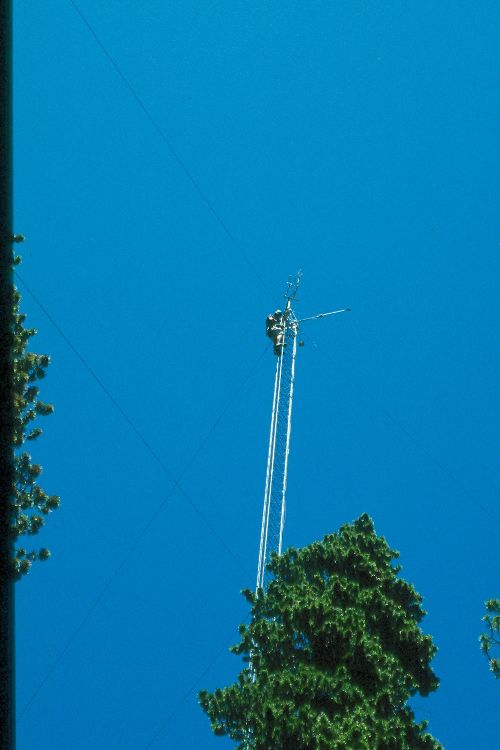
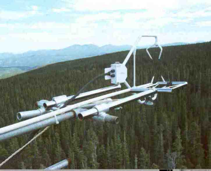
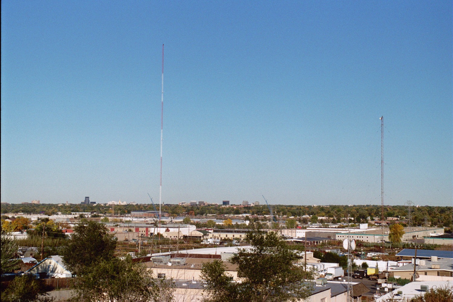
USGS 33m tall tower at Niwot Ridge (left). Fast response (eddy covariance) instruments at the top of the USGS tower (right).
Carbon Dioxide (CO2) uptake by a subalpine forest andnocturnal drainage flow of CO2 at the Niwot Ridge, Colorado Ameriflux site. Our work at a subalpine forest near the Continental Divide west of Boulder, CO. aims to improve our understanding of biophysical controls on forest-atmosphere exchanges of carbon dioxide (CO2) and heat, and, evapotranspiration (ET). Measurements of the net exchange resulting from photosynthetic uptake of CO2 and respiration from soil and vegetation are conducted above canopy from tall towers on which fast response instrumentation is installed. These measurements which began in 1999 and are continuous and are made 10 times per seconds
During the night, drainage flows often carry CO2 downslope, evading detection by the fast response sensor at the top of the tall towers. Our site was among the first to use a continuous CO2 advection flow measurement system in the forest canopy and we have the longest known record of such measurements (7 years). We report (Ecological Applications, 2008) that substantially less CO2 is being sequestered from the atmosphere by this subalpine forest site than is estimated by conventional means.
|
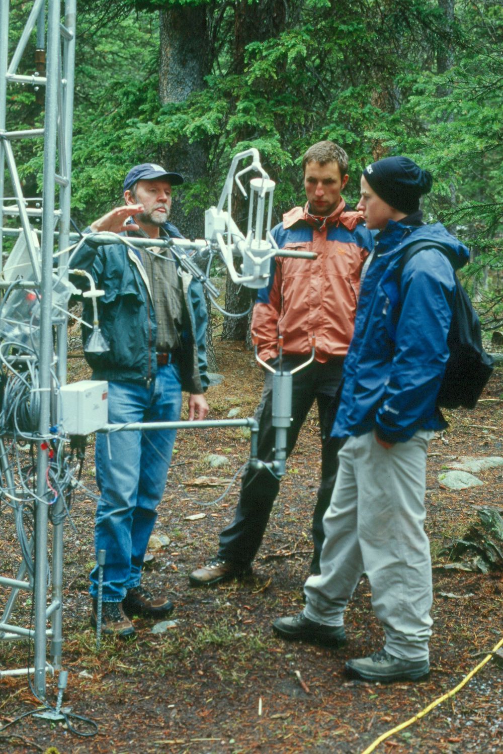
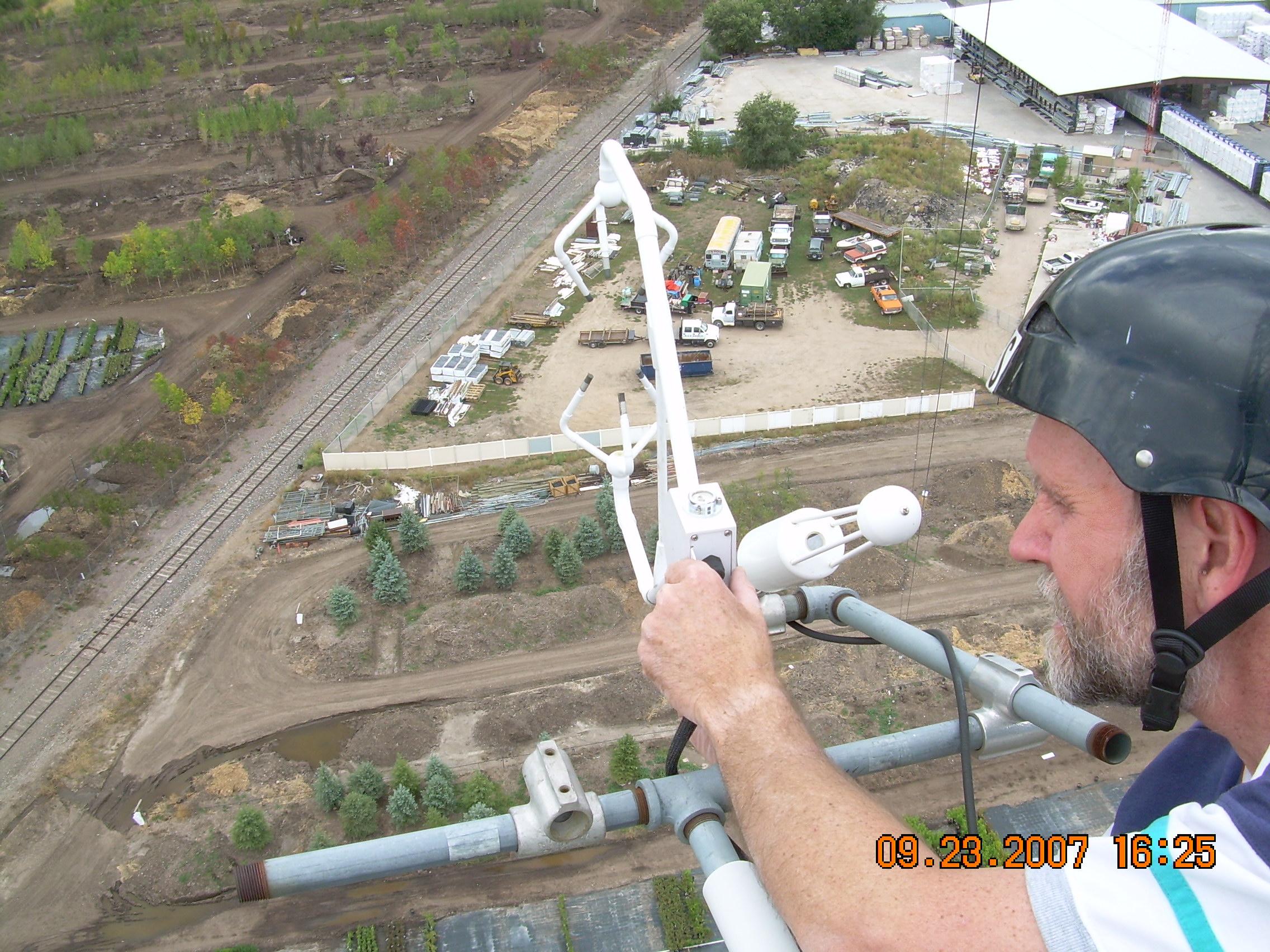
Visitors at the sub-canopy USGS tower discuss wind sensing alongside sonic anemometers at Niwot Ridge (left). The 4 tower experimental design for measuring nocturnal transport of CO2 (right).
Since drainage flows (nocturnal transport of CO2 downslope) occur in almost all forests and CO2 transported by them is usually missed by conventional measurements conducted above the forest canopy, global estimates for forest carbon sequestration may be substantially overestimated. Using the carbon isotope (C13), we illustrate the intensity of CO2 carrying drainage flows and the significance of contributions from soil and canopy respiration to the overall ecosystem CO2 flux (Ag & Forest Meteorology, 2008).
Greenhouse gases (CO2,CH4,N2O) and water vapor fluxes (ET) over an urban area (Denver). Urban ecosystems cover a small fraction of land (urban city centers ~4%), yet the bulk of anthropogenic greenhouse gas emissions (78% of all anthrop. CO2 emissions) occur there, as well as, 60% of all residential water use. The vegetative sink of CO2 can not be ignored in urban ecosystems. For Denver, lawns cover nearly 34% of the surface while 5-15% is also covered by shrubs & trees. [Other studies show that lawns are the largest (area) irrigated crop in the US-surpassing corn.] However, the benefits of CO2 sequestration are somewhat offset by N2O emissions from lawns since they are well watered & well fertilized. Measurements of ET and net CO2 exchange are conducted from a tall tower while lawn exchanges are measured with ground surface chambers. Diurnal vertical atmospheric profiles of CO2, CH4, and N2O concentrations (another first in a city) gathered in 2007 indicate strongly heterogenous surface fluxes and a potentially strong challenge to convention means of determining surface-atmosphere gas flux over a surface.
|
The Denver 120m tall tower for measuring CO2 exchanges over an urban ecosystem (left). Checking fast response eddy covariance method instruments at 60m (right).
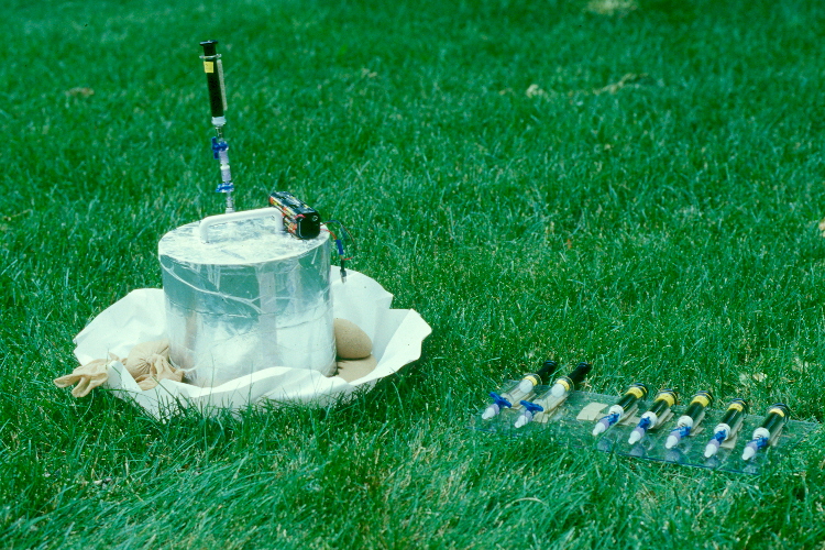
Closed chamber system for measurement of soil-surface exchanges of methane and nitrous oxide using air-tight syringes. Samples are returned to our labs for analysis with a gas chromatograph.
|
Field work in Romania along the Aries River System (northern Romania).
Field work in Romania along the Aries River System (northern Romania) installing suction lysimeters for contaminant solution sampling and also other equipment. This unsaturated zone hydrology project investigated pollution arising from mining activities in the area to determine rates of movement of chemicals off-site of catchment dam areas as heavy metals and other mining products moved through the geologic media. This is the Abrud Mines Catchments Dam, one of several, which had filled to capacity. The goal of this project was to assist the Romanian Government in its attempt to join the European Union who requested that Romania take environmental mitigation measures along the Aries River that flows into the Danube River. Water in the Danube is shared by multiple countries in Europe. The USGS routinely takes on such tasks around the world in assistance of many governments and their respective agencies.
|
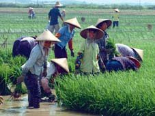
A picture of rice production in Hanwang, China.
A picture of rice production in Hanwang, China where our project initiated research investigating the fate of municipal waste-water irrigation and agricultural chemical transport as affected by farm-management practices within the unsaturated zone and its effect on groundwater quality. This project utilized field data from rice paddies, a rainfall simulator with height adjustments to 20 m at Hohai University in the Soil-Plant-Atmosphere-Continuum Facility, and seven agricultural lysimeters, each with 10 square meters of surface area, with paired depths of 1.5, 3, and 5 m; the seventh lysimeter was a 10x10x10m weighing lysimeter. All lysimeters were located in the North Field area of the Han Wang facility. This project was initiated in cooperation with the USGS Unsaturated Zone Field Studies Group based in Denver, the Han Wang Hydrologic Field Station in Xuzhou, China, Hohai University Department of Hydrology in Nanjing, and Chinas Ministry of Water Resources in Beijing.
|

