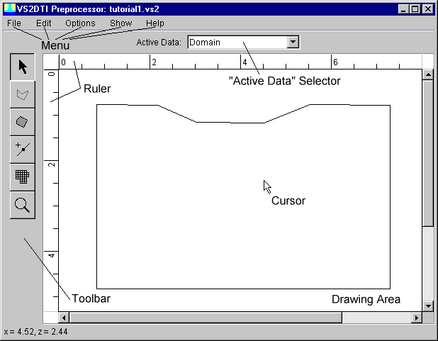
To view and/or modify the model domain, select "Domain" from the "Active Data" selector.
The simulated domain is roughly rectangular in shape. The top of the domain represents land surface. There is a slight depression in the center of the surface. It is in this depression that contaminant will be introduced. The bottom of the domain is assumed to be impermeable rock upon which a perched water table may exist. The side boundaries are treated as no-flow boundaries except near the bottom where seepage faces are allowed to develop.
You may:
Next step: Textural Map
Previous step: Drawing Area
Return to: