|
Aerial Infrared Videography of Sandhill Cranes
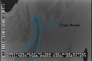
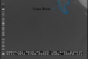
Each spring over half a million sandhill cranes and a number of endangered whooping cranes use the Platte River as critical staging habitat during their northern migration. Changes in land use and river morphology are believed to have altered the feeding and roosting patterns of sandhill cranes. A pilot study was initiated by an interdisciplinary team of USGS scientists during the spring 2000 migration season to test the efficacy of using aerial infrared videography to image sandhill cranes roosting in the Platte River. The video system was used at higher altitudes to resolve the roosting locations of sandhill cranes along the entire width of river channel (See Below). These images were used within a geographical information system (GIS) to generate accurate maps of sandhill crane roosting locations along the 85 miles of river between Lexington and Grand Island, Nebraska. Lower altitude flights were used to resolve individual sandhill cranes (See Below) and compute densities. Infrared videography is a promising research tool to monitor the population of sandhill cranes along the Platte River.
 |
 |
High Altitude Image (~ 2000 ft)
Click to view animation |
Low Altitude Image (~ 1000 ft)
Click to view animation |
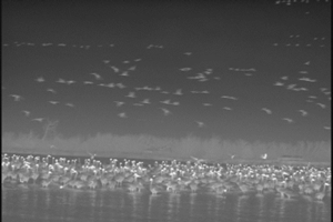 |
Infrared Video of Cranes
Landing
Click to view animation |
Cottonwood Ranch Monitoring and Research
Background - "The Platte River Endangered Species Partnership (PRESP) is developing a proposed Program that will undertake a number of management activities to modify both land and water to increase or improve habitat for least terns, piping plovers, and whooping cranes. As directed under the Federal Energy Regulatory Commission (FERC) License for Project 1835, Article 407, Nebraska Public Power District (NPPD) will provide to PRESP approximately 2,650 contiguous acres of land on the central Platte River between the J-2 Return and Elm Creek, known as the Cottonwood Ranch Property. This property will count towards the program’s first increment goal of 10,000 acres. A conceptual plan for development and enhancement of the Cottonwood Ranch Property was developed by NPPD in consultation with the Nebraska Game and Parks Commission (NGPC), the Governance Committee and their representatives, Central Nebraska Public Power and Irrigation District (Central) and the U. S. Fish and Wildlife Service (FWS)." (Excerpt from: Research Protocol for Nebraska Public Power Disctrict's Cottonwood Ranch Property)
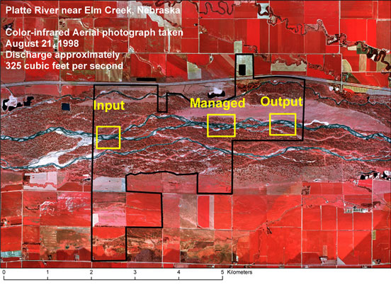 |
| 1998 color-infrared (CIR) photo showing the boundary of the
Cottonwood Ranch (black) and
location of monitoring sites (Input, Managed and Output reaches shown in
yellow) |
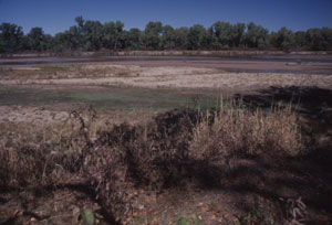
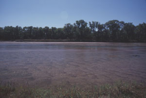
The Development and Enhancement Plan calls for removal of channel bank vegetation to promote bank erosion and channel widening. The USGS has developed a research plan to investigate the geomorphic effects of the management plan by monitoring selected reaches of the Cottonwood Ranch. The overall goal of the monitoring is to provide the necessary data to evaluate channel rehabilitation practices. Specific questions are focused on whether the management activities cause measurable changes downstream, and whether managed habitat can be sustained through river processes or if long-term maintenance needs are required.
Status - The first round of pre-data collection within the Cottonwood Ranch Property was completed during September and October 2000.
 |
 |
| Input
monitoring reach |
Output monitoring reach |
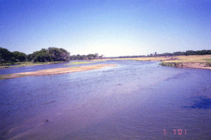 |
Click to view how the river changes
over a 6 week period. Single photos were taken each day from a stationary camera at the
Output reach to create this animation.
|
|


)
)
)