Watershed Modeling
USGS Home
Contact USGS
Search USGS

USGS Home
Contact USGS
Search USGS

USGS Home
   Accessibility       FOIA       Privacy       Policies and Notices
Government Made Easy
Take Pride In America
U.S. Department of the Interior | U.S. Geological Survey
URL:
Page Contact Information: MoWS Contact Form
Page Last Modified: 16 September, 2014
A Geospatial Fabric For National Hydrologic Modeling

The Modeling of Watershed Systems (MoWS) project, part of the USGS Water Mission Area's National Research Program, conducts research into surficial hydrologic processes and their simulation.  Software, including simulation models, geographic information systems (GIS), data handling tools, and data sets are produced as part of the project output. This web page is the home page for national GIS data sets that form a common Geospatial Fabric for hydrological modeling across the United States.

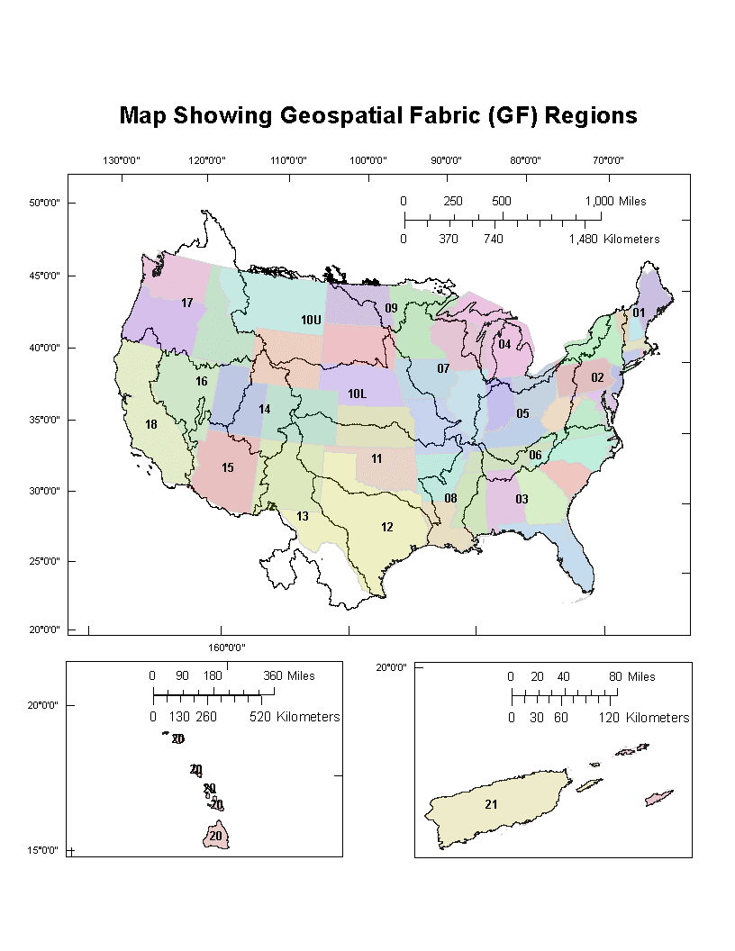
The Geospatial Fabric currently includes two main products: 1) GIS features and 2) tables of attributes about those features. Each of these data products is distributed according to a set of regions defined for the country, as shown below. The portion of the respective data product for a given region is available in an ESRI file Geodatabase (version 10.2). The attribute tables from one Geodatabase can be joined to the GIS features of another using standard relational operations in the ArcGIS platform, enabling the user to visualize spatial patterns of attributes or conduct further analyses.
Home | People | Software | Data | Recordings | Training | Related Links | FAQ | Help
1) Geospatial Fabric Features for National Hydrologic Modeling

The GIS feature data set, referred to as  Geospatial Fabric Features for National Hydrologic Modeling, includes a river routing network, land surfaces that contribute to the network (referred to as Hydrologic Response Units or HRUs), and Points of Interest (POIs) located along the network.  The Geospatial Fabric Features can be used for creating maps of the feature outlines or, by relating to the attribute tables, to show the spatial patterns of landscape characteristics, or for spatial analyses.

The data are here: http://dx.doi.org/doi:10.5066/F7542KMD

A full Federal Geospatial Data Committee metadata record is provided with the data content, describing the initial data sources and processing methodology used to derive the GF Features.

2) Preliminary spatial parameters for PRMS based on the Geospatial Fabric, NLCD2001 and SSURGO

The set of tables is referred to as Preliminary spatial parameters for PRMS based on the Geospatial Fabric, NLCD2001 and SSURGO. This set of attributes are referred to here as parameters because they have been specifically derived and named according to previously published methodologies (Viger and Leavesley, 2007) to be suitable for starting input parameter values for the application of the USGS PRMS watershed model. The term preliminary is used here to indicate that the user should critically evaluate the parameter values and adjust as needed for their own work.
 
The list of tables is here: http://dx.doi.org/doi:10.5066/F7WM1BF7. In reality, the metadata record referred to by the Digital Object Identifier (DOI) in the preceding sentence points to 6 other DOIs, each of which defines a thematic subgroup of parameters as follows:

soils parameters: http://dx.doi.org/doi:10.5066/F7RX9937 
land cover parameters: http://dx.doi.org/doi:10.5066/F7N58JD8 
topographic parameters: http://dx.doi.org/doi:10.5066/F7445JHG 
geography parameters: http://dx.doi.org/doi:10.5066/F7HD7SPJ 
subsurface flux parameters: http://dx.doi.org/doi:10.5066/F7CN71XR 
surface depression parameters: http://dx.doi.org/doi:10.5066/F70C4ST6
 
The soils parameter tables were derived based on Soil Survey Geographic (SSURGO) Database (Soil Survey Staff, Natural Resources Conservation Service, United States Department of Agriculture, 2012). The land cover parameters were based on the National Land Cover Database from the year 2001 (Homer and others, 2007). The geography parameters were derived from the geometry of the Geospatial Fabric Features themselves and used no ancillary data. The subsurface flux parameters were derived from a map of hydrogeology and permeability (Gleason and others, 2011). The surface depression parameters, which describe the presences of smaller waterbodies within HRUs, were derived from an extract from the high resolution version of the National Hydrography Data (NHD; McDonald and others, 2012).

A full Federal Geospatial Data Committee metadata record is provided with each set of tables, describing the initial data sources and processing methodology used to derive the parameters.


Gleeson, T., L. Smith, N. Moosdorf, J. Hartmann, H. H. Dürr, A. H. Manning, L. P. H. van Beek, and A. M. Jellinek (2011), Mapping permeability over the surface of the Earth, Geophys. Res. Lett., 38, L02401, doi:10.1029/2010GL045565.

Homer, C., Dewitz, J., Fry, J., Coan, M., Hossain, N., Larson, C., Herold, N., McKerrow, A., VanDriel, J.N., and Wickham, J., 2007, Completion of the 2001 National Land Cover Database for the Conterminous United States, Photogrammetric Engineering and Remote Sensing, Vol. 73, No. 4, pp 337-341, http://www.mrlc.gov/nlcd01_data.php.

McDonald CP, Rover JA, Stets EG, Striegl RG (2012) The regional abundance and size distribution of lakes and reservoirs in the United States and implications for estimates of global lake extent. Limnology and Oceanography, 57, 597-606.

Soil Survey Staff, Natural Resources Conservation Service, 2012, Soil Survey Geographic (SSURGO) Database, United States Department of Agriculture : http://sdmdataaccess.nrcs.usda.gov/, accessed 7/2013.

Viger, R.J., and Leavesley, G.H., 2007, The GIS Weasel user's manual: U.S. Geological Survey Techniques and Methods, book 6, chap. B4, 201 p.

Recommended Citations
When using these data, citing both data products is recommended:

Viger, Roland J. and Bock, Andrew, 2014, GIS Features of the Geospatial Fabric for National Hydrologic Modeling, US Geological Survey, http://dx.doi.org/doi:10.5066/F7542KMD.

Roland J. Viger, 2014, Preliminary spatial parameters for PRMS based on the Geospatial Fabric, NLCD2001 and SSURGO, US Geological Survey, http://dx.doi.org/doi:10.5066/F7WM1BF7.