
Coeur D'Alene River
Over one hundred years of mining in the Coeur d’Alene Basin has resulted in large quantities of metal-enriched sediments being transported to, and deposited within the Lower Coeur d’Alene River and its floodplain. The South Fork of the Coeur d’Alene River flows through the Coeur d’Alene Mining District, one of the world’s largest producers of silver and one of the Nation’s largest producers of lead and zinc. More than 130 million tons of lead-zinc-silver sulfide ores have been mined from the district since the mid-1880s. From the 1880s to 1968, waste materials (tailings) from the mills were placed directly into the river. These tailings were then transported downstream by the river, especially during high flows, and deposited in the lower reaches. During times of flooding, the Lower Coeur d’Alene River Valley can be completely inundated because of its flat topography, resulting in the deposition and/or remobilization of metal-enriched sediments from the main channel or floodplain. The lower valley has been repeatedly inundated during the period of mining upstream, with the latest event occurring in 1997. Metal-enriched sediments continue to be transported by the river during moderate to high flows despite restoration of mine tailings upstream.
The contaminated sediments are deposited throughout the fluvial system including: the streambed, streambanks, floodplain, and lateral lakes of the Lower Coeur d’Alene Valley. This reach of river is the focus of several mitigative efforts aimed at preventing these sediments from being remobilized and carried downstream. Remedial Investigation/Feasibility Studies (RI/FS) conducted in the basin under the Superfund Act resulted in a Record of Decision that requires the implementation of a long-term remediation of metal contamination within the Coeur d’Alene Basin.
Objectives
The objectives of this project are to develop an understanding of the extent of floodplain inundation as a function of flow and Coeur d’Alene lake level, the potential mobility of sediment in the main channel and floodplain as a function of flow, and to develop insight into the potential exchange and distribution of contaminated sediments from the main channel to the floodplain and conversely from the floodplain to the main channel during high flow events.
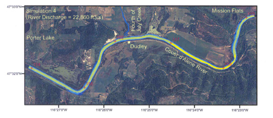
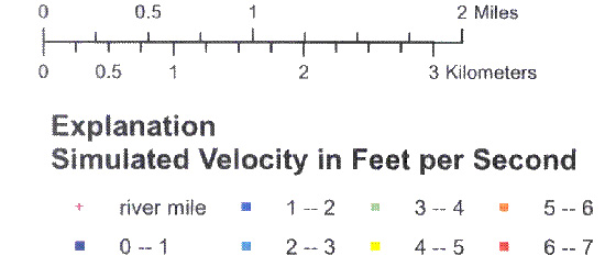
Flow calculation overlaid on aerial photo.